 Driving across the high plateau of eastern Oregon, west of Vale.
 Abandoned car near Milliken.
 Afternoon skyline near Sisters.
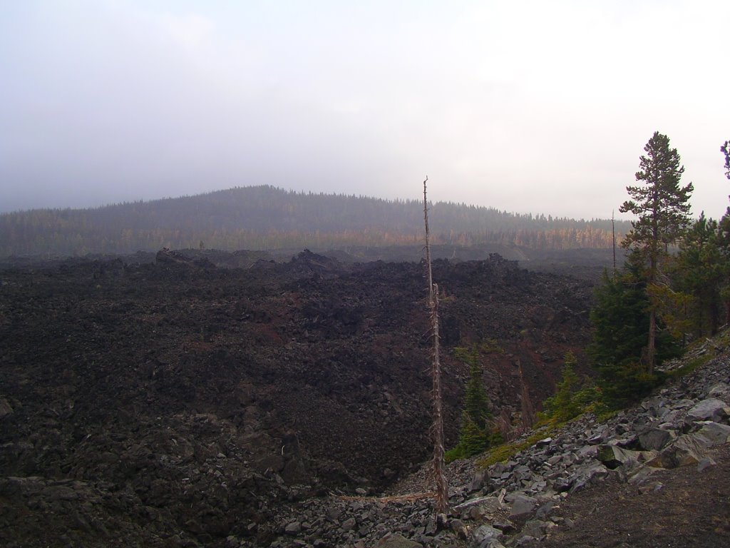
McKenzie Pass, elevation 5,325 feet above sea level.
Lava field, Cascade Mountains west of Bend.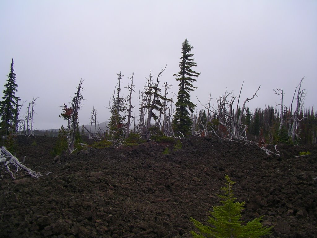
Dead trees atop the spine of the Cascade Range.
Hauling ass down the Cascade Mountains, headed towards the Pacific Ocean:
9.30.2006
Crossing Oregon
9.28.2006
The Oregon Outback
 We're somewhere in the middle of nowhere. Not the cliched "middle of nowhere" that we joke about when driving through a one-light Michigan farm town with a Dairy Queen and a chinese buffet and a gas station with a Subway. In this dead-nuts true middle of nowhere, cell phone coverage ended long ago and days can pass before other people are seen. We can only be in one place: southeast Oregon, nestled in the corner between the northern border of Nevada and the western edge of Idaho.
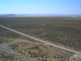 Located south of the high desert town of Burns, the Harney Basin is a desolate and uninhibited wasteland, comprised of millions of acres of sagebrush-covered ridges and dry alkali lake beds. Old wagon and cattle trails criss-cross the barren landscape like the joined strands of a spiderweb. If someone wanted to disappear, really disappear, there is no easier place to get dangerously lost than the span of earth where the place names on the map ("Wagontire", "Blitzen", "The Narrows") are seperated by nearly one hundred miles.
 Signs of life are few and far between. The silhouette of a raven in the cloudless sky. Jack rabbit tracks skip across dirt roads covered with a layer of talcum powder dust. Abandoned ranches, unoccupied for who-knows-how-long, sit forlorn and empty next to dry water troughs. We'd been through here before and once ran into a cattle wrangler named Jerry. He was picking the feathers from an egg-laying chicken he found at one of the abandoned homesteads. He built a fire of sagebrush twigs and tossed the chicken into the burning brush. After several minutes, Jerry kicked the fire apart and pulled out the bird, burnt to a crisp. He bit into the charcoal-black skin and red drops of blood dripped down his handle-bar mustache. Burnt to ash on the outside, raw on the inside, Jerry didn't flinch and ate the whole chicken, stopping only to get on all fours and slurp a drink of water from a mud puddle.
 Southeast Oregon is a place where cattle outnumber people 200 to 1, where only one radio station (country, of course) comes in clear on the radio dial ("KZZR AM, the voice of no choice!"), where the cowboy west still exists, minus all Hollywood romantic illusions. And at night, in a black sky completely free of light pollution, thousands of stars shimmer brilliantly over the barren desert lanscape.
9.27.2006
Jackson Hole
 Flanked by the dramatic Teton mountains, Jackson Hole, Wyoming is one of the most spectacular places in the United States. We've spent a bit of time here over the years, both as a resident and as a tourist. Like so many other sun-kissed and snow-blessed western locales, the area has seen considerable change in recent years. Much like Aspen, Colorado and Sun Valley, Idaho, Jackson Hole has transitioned from a remote mountain hideaway into a playground for global jetsetters and the megawealthy.
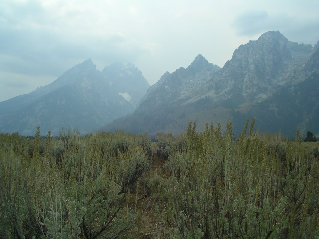
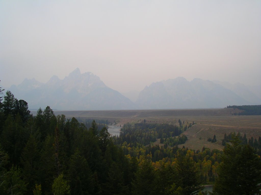 For thousands of years, Blackfoot, Crow, Gros Ventre, and Shoshone Indians built summer camps along the Snake River. The first European to explore the area was a Kentuckian named John Colter. An integral member of the Lewis and Clark expedition, Colter ventured into the area in 1807 in search of beaver pelts. Other mountain men and trappers followed, and by the late 1800's, cattle ranchers established permanent settlement. In 1929, the government established Grand Teton Natonal Park and purchased most of Jackson Hole (ringed by mountains and sixty miles long, the valley floor is 6,400 feet above sea level. Grand Teton, the highest peak in this smoky photo, towers above the range at 13,770 feet).
 The town of Jackson lies at the southern end of the valley. The merchants and restraurants occupy an interesting economic landscape; high-end western bronze art galleries and exclusive bistros with world-renowned chefs share the wooden sidewalks with rowdy country bars and old-west themed tourist traps. Ripley's Believe It or Not neighbors the exceptional Thomas Mengelsen art gallery. A busload of Japanese tourists sit in the saddle barstools at the The Million Dollar Cowboy Saloon. Next to Jack Dennis Fly-Fishing shop is a Benetton store, just like the one at Sommerset Mall in Troy.
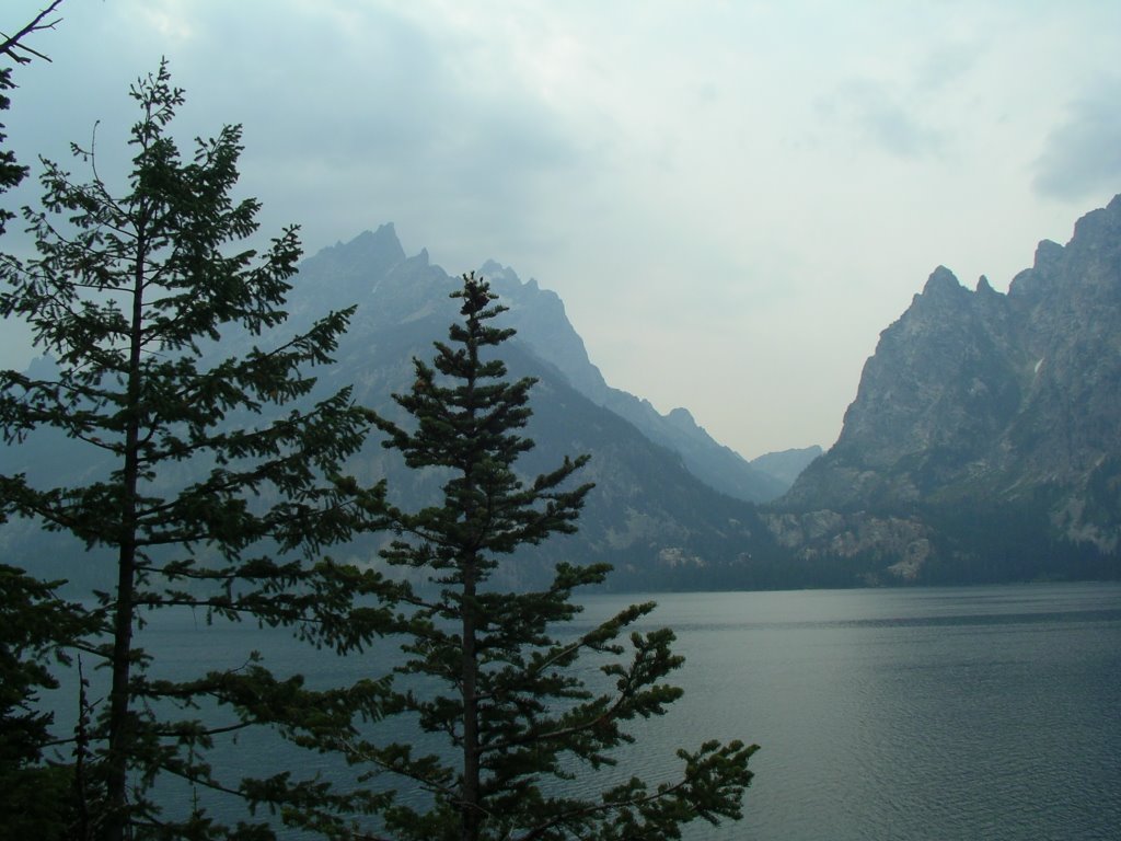 As we sat on the second-floor deck at the Rancher Bar, a golden eagle crossed the sky and landed on a rocky perch. As schmaltzy as the town of Jackson has become, Jackson Hole still has a rugged beauty found nowhere else in the lower forty-eight states. Jenny Lake (seen here) is one of the most beautiful mountain lakes in the country. For those willing to venture from the pavement, countless miles of trails penetrate deep into remote wilderness.
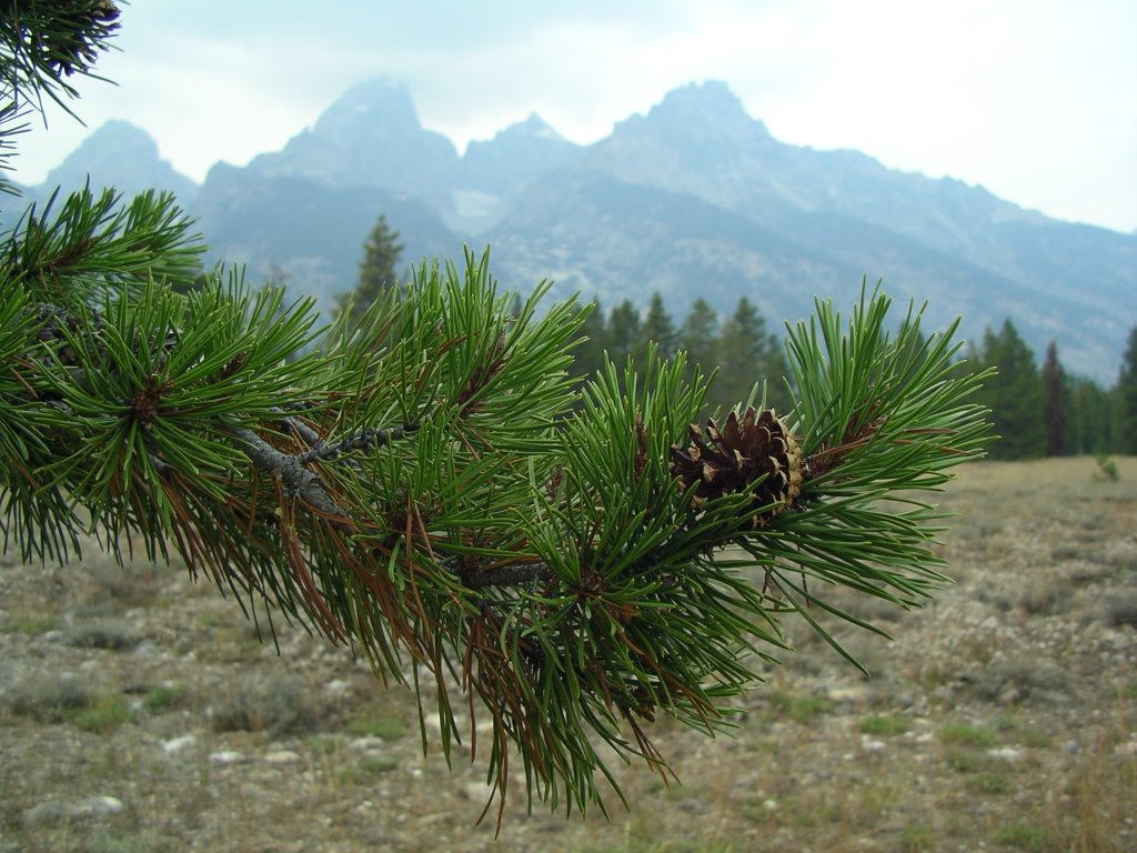 Few people of moderate means live in Jackson Hole, as the area has become a haven for movie stars and titans of commerce. (Harrison Ford and Steve Forbes are among many of the crazy-rich residents). On one visit to the Jackson K-Mart (yes, K-Mart. It has a faux log cabin exterior and sells the same sub-standard merchandise at inflated prices as any K-Mart), a Bentley parked next to us and four men in tunics and keffiyehs on their heads emerged. They were probably members of some royal family from some oil-rich emirate who also own vacation homes in Saint-Tropez and the Cayman Islands. They might have a couple more nickels in the bank than we do, but we doubt they know how to four-count cast a wooly bugger fly for Snake River cutthroat trout.
9.25.2006
Bonanza City
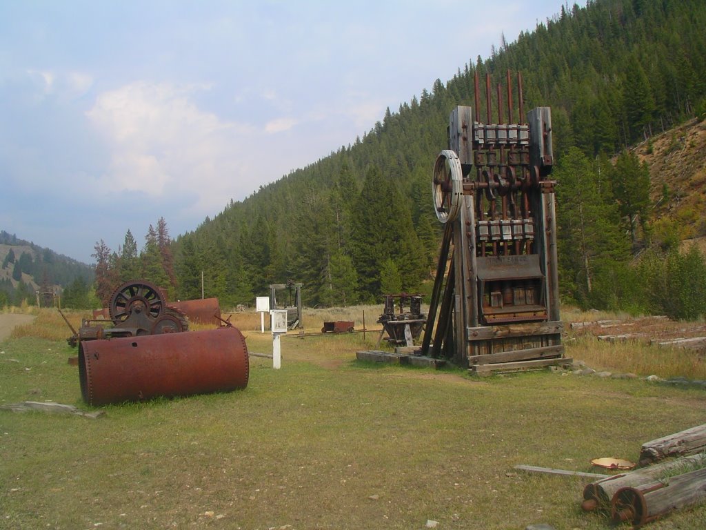
 Deep in the Idaho mountains and miles from the paved road, the ghost town of Bonanza City sits along the Yankee Fork of the Salmon River. In 1873, "placer" gold, or tiny flakes that eroded from exposed veins and settled in alluvial sediments of creeks and streams, was discovered in the river. Five years later, 1,500 people lived in the bustling boomtown community of Bonanza City. Today, the only inhabitants are the mountain goats on the craggy hillsides.
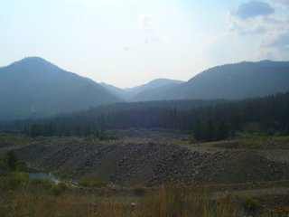 At first, grizzled miners scooped up sand and pebbles from the river in metal pans and aggitated the sediments looking for tiny flakes. As technology improved, more efficient and ecologically destructive methods of placer mining evolved. The panners were replaced by steam shovels that could scoop up entire river bottoms. Powerful hydraulic water cannons blew massive amounts of rock and dirt from the river bank. By the time the claim dried up in the 1930's, the natural hydrology of the Yankee Fork was forever obliterated. The mounds of gravel along the meandering creek bed are scar tissue from a wound that will never heal.
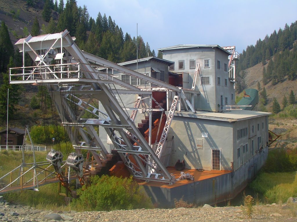 By 1938, six million cubic yards of earth had been displaced. At the time, the total value of the gold recovered from the Yankee Fork operation was 11 million dollars- so roughly speaking, fifty cubic feet of river-bottom produced two bucks worth of gold. A gold dredge was built (seen here) to re-process the piles of gravel, extracting an additional 1.2 million dollars worth of gold flakes. Sometimes you can squeeze blood from a turnip. The dredge operation ended in the 1950's and has since been re-built by former employees for visitors to see.
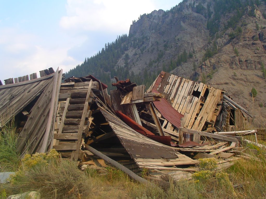
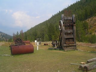 After the gold ran out, after two forest fires burned the area, the residents of Bonanza City moved elsewhere. Like so many of the gold rush towns in the west, most of the equipment was salvaged and removed after the claim ran out, except for the largest and heaviest of items. The ruins of Bonanza, once a city with running water and saloons, is now a cluster of collapsing cabins and rusting ironworks.
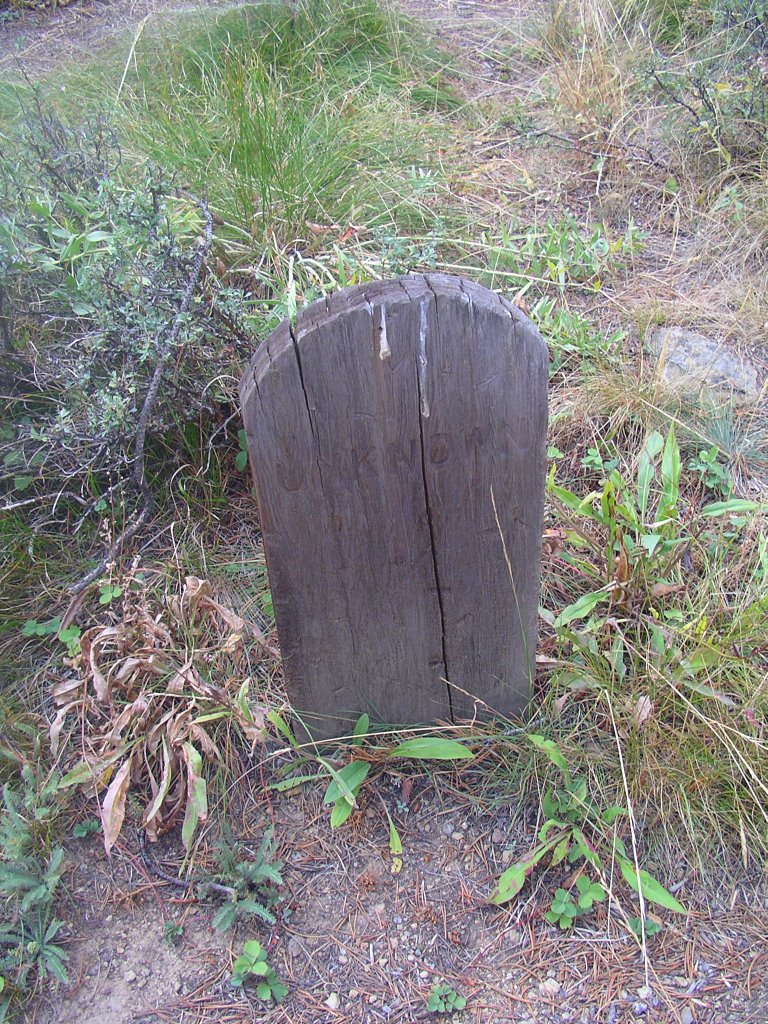 At the nearby Boot Hill cemetary, wooden grave markers (many inscribed with "UNKNOWN") lie scattered among clumps of high sagebrush. Boot Hill cemetaries were named such because the interred usually died penniless and violently (such as a gunfight or a mine accident), and they were buried quickly in a pine box with their boots still on their feet. No one knew who they were or where they came from or asked any questions. After the gold rush ended and the scavengers removed anything and everything of value from Bonanza City, after placer mining destroyed the fishery and riparian habitat, the fading grave markers are one of the few signs there was once life on the Yankee Fork.
9.23.2006
The Two Idahos
Instead of yabbering away for another posting, we're going to depart from the standard RR format a bit. We'll do this collage style: a collection of photographs illustrating the contrast between the Idaho of Old and New Idaho. In many parts of the state, Idaho is still the classic west, where hard-scrabble and self-reliant people eke out difficult lives as ranchers, miners, or loggers. But over the years, a new Idaho has emerged: Boise is a modern high-tech city (thanks to Micron) which has doubled in population in the last ten years. In Ketchum/Sun Valley, the average price of a home has surpassed one million dollars. Here's a random mix of photographs from across the state illuminating the difference between the two Idahos: West of Victor, an abandoned home with a mountain view sits amidst amber wheat fields.
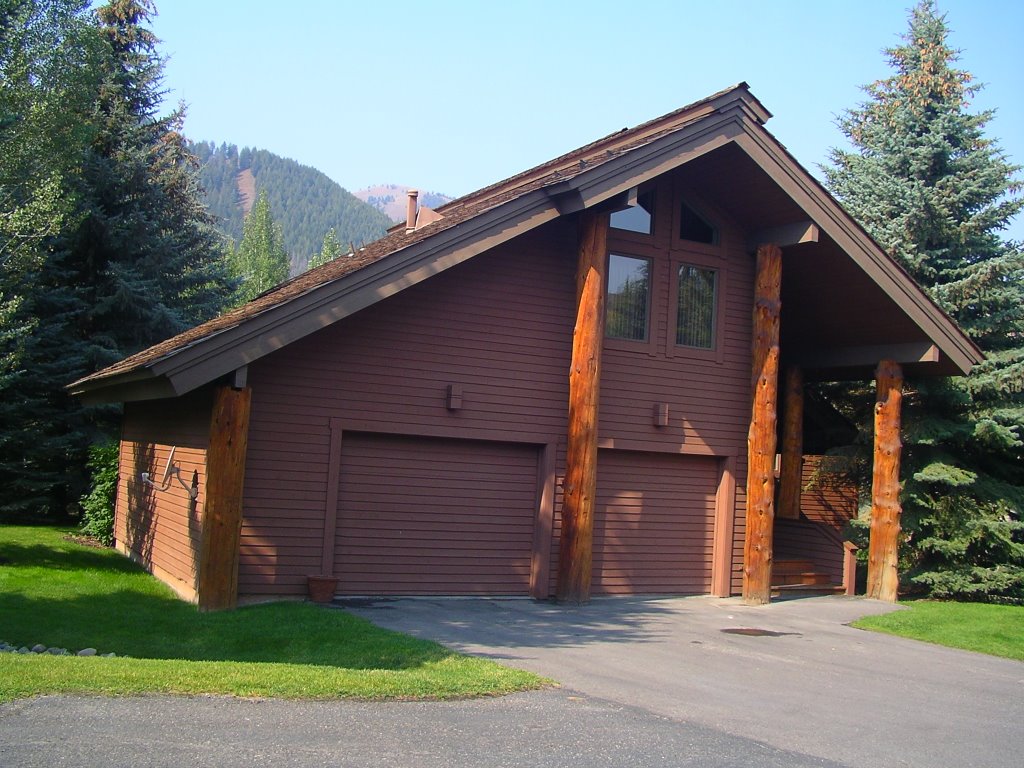 South of Sun Valley, a vacation home with a mountain view sits amidst other mansions in an exclusive neighborhood.
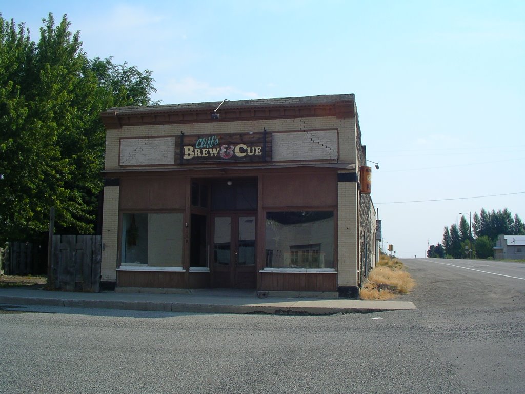
 In Lincoln County, Brew and Cue owner Cliff Killen sometimes mingles with the crowd on chicken gizzard Saturdays.
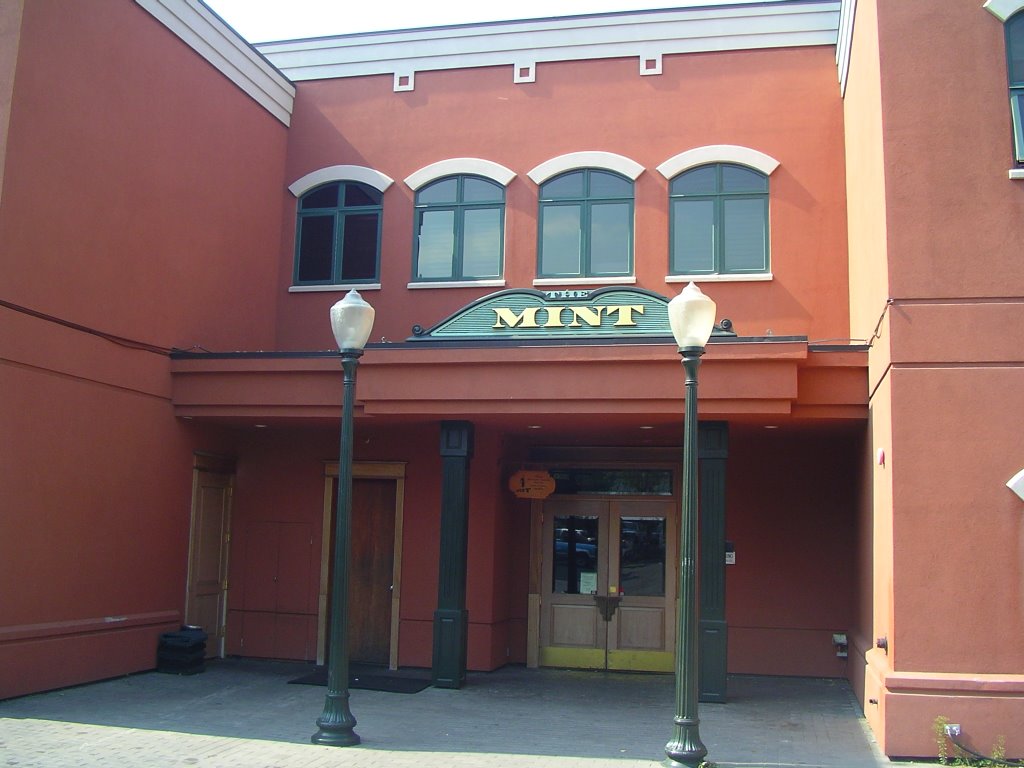 In Blaine County, The Mint owner Bruce Willis sometimes mingles with the crowd on Latin disco Saturdays.
 In Driggs, the only thing left at the fire station worth a few bucks is the coffee urn.
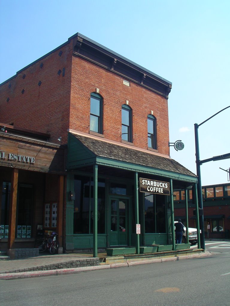 In Ketchum, the fire station only serves Starbucks in the coffee urn.
 Along the western front of Mt. Borah, an AM radio station crackles out an Alan Jackson song.
 Along West Front Street in Boise, a FM radio station booms out a 50 Cent (aka Curtis Jackson) song.
9.22.2006
Redfish Lake
 Under the jagged outline of the Sawtooth Mountains and some 900 river miles inland from the Pacific Ocean, Redfish Lake is the historical beginning and end for the Idaho sockeye salmon. Named Redfish Lake by early trappers for the distinctive red color of sockeyes, the lake has played an important role in the lifecycle of countless sockeye for thousands of years. That is, until seventy years ago, when the first of eight major hydroelectric dams on the Columbia and Snake Rivers was constructed.
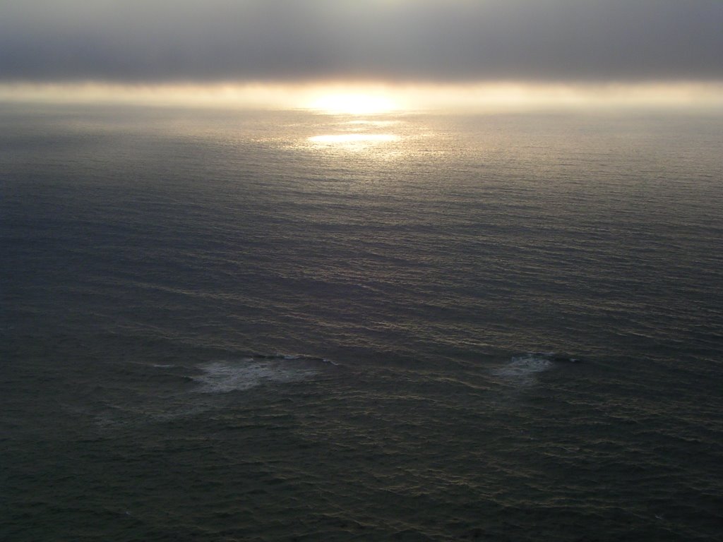 The natural range for sockeye is the "Ring of Fire" (no, not the "ring of fire" y'all suffer the morning after eating a tall pile of mango habanero wings at Buffalo Wild Wings). We're referring to the volcano-dotted zone of the north Pacific Ocean which arcs from northern California to northern Japan. Sockeye spawn only in streams with lakes in their watershed, where they spend three years maturing before heading out to sea. The next one to four years are spent in ocean waters eating nothing but delicious plankton, a feature unique only to sockeye and the speculated reason for their striking red hue. When they migrate back to their ancestral spawning beds, biologists believe they smell the path to their place of origin. Somehow, this honed sense can distinguish the many tributaries which pour into the Columbia and Snake river system.
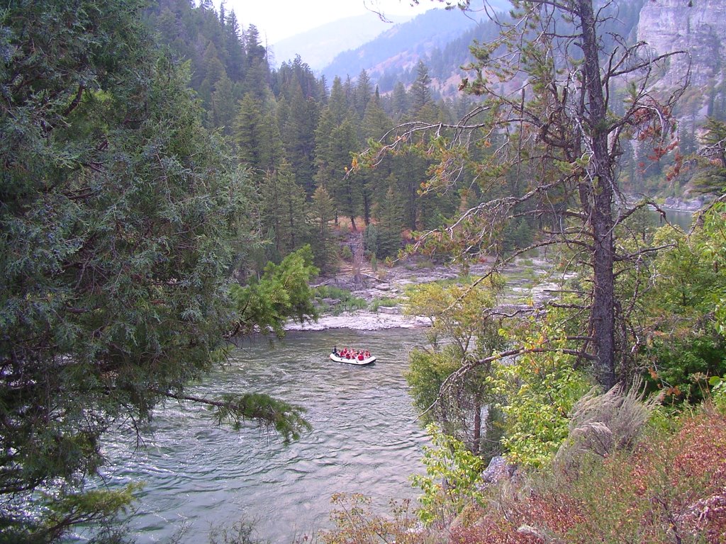 The dams changed this timeless cycle forever. Most young fish are pulverized as they pass through massive electric-producing turbines. Provided they get past eight major dams and survive ocean life, the few fish that have made it to this point (1 out of 1,ooo), will begin to return home. At the base of the dams, where the fish congregate before entering fish ladders, California sea lions prey on the sockeyes like fraternity boys in front of a freshmen girls dorm. Atop each dam, the rivers widen and deepen and the current slows, making upstream navigation more difficult. After construction on each dam was completed, the sockeye numbers dropped more and more. Before the dams, 35,000 fish were estimated to return to Redfish Lake. By 1955, the number was down to 4,000. In 1992, one bachelor male, nicknamed "Lonesome Larry" returned. Unfortunately, without a bed of eggs to fertilize, his presence made little difference.
 Attempts to remedy the situation have been on-going since the 1970's. Millions of dollars have been spent studying the effect of dams on sockeye, with one reccuring conclusion: dams are bad for sockeye. Millions of dollars have been spent producing eggs and raising fry in hatcheries (as seen here at the Sawtooth Fish Hatchery). Millions of dollars have been spent barging and trucking young fish around the dams for release into the lower Columbia River. Upon getting dumped into the flaccid river, they swim around and around in clouds of their own feces; clueless oncorhynchus nerka retards without any survival instincts or sense of direction.
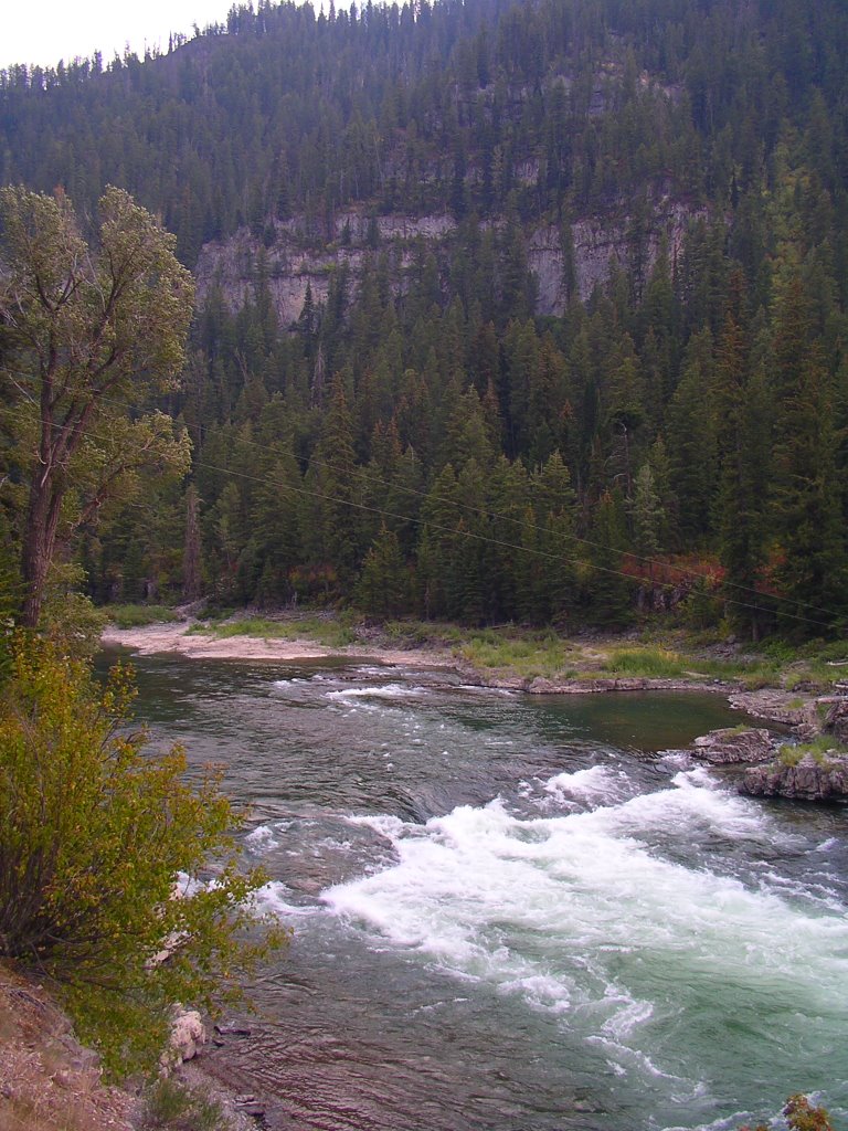 As a result of the dams, Seattle and Portland enjoy the lowest electrical rates in the country. As a result of the dams, grain barges can travel 600 miles inland and Lewiston, Idaho is now a seaport. As a result of the dams, irrigation projects have converted hundreds of thousands of acres of arid land in Washington and Oregon into wheat and potato farms. To many, these are good things. Water flows uphill towards money and power, always has, always will. For the Idaho sockeye, the benefits have been devastating.
9.21.2006
Hemingway's Own Private Idaho
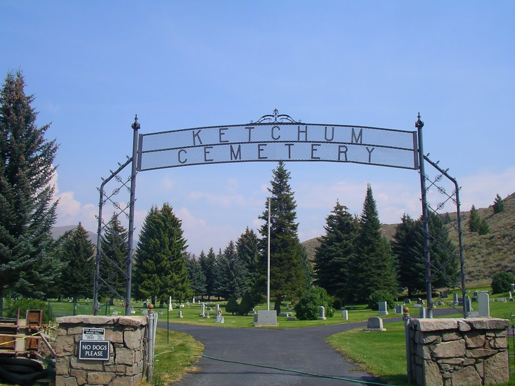 Nestled under a grove of stately spruce trees at the Ketchum Town Cemetary is the gravesite of Ernest Hemingway. Even though he was raised in Illinois (and spent summers in northern Michigan at a family cottage), and also lived in Florida and Cuba, his ultimate resting place is the the Wood River Valley, below alpine mountain peaks and the turquoise Idaho sky.
 Hemingway first came to Idaho in 1939 for a stay at the Sun Valley Lodge (where he wrote For Whom the Bell Tolls in room 206). At the time, Sun Valley was a vacation destination for the rich and famous (actually, still is. Part-time residents include Bruce Willis and Arnold Schwarzenegger and Rolling Stone magazine founder Jann Wenner, among many others). Apparently Hemingway liked the area so much he made Idaho his second home for the next 22 years, until his death in 1961.
 Despite the recognition of being one of America's pre-eminent writers, despite his mythic status as a boxer and a bullfighter, a safari hunter and a man of high adventure, the reality was Hemingway was a deeply-flawed and fallible individual. Not that this is unusual among genuises, but for all his talent, he was to many people, frankly, a total bastard. While those who knew him socially speak with affection of his warmth and generosity, the people closest to him remember a man who was often distant and sullen. Acquintances say he was a master storyteller who would entertain for hours at Ketchum nightspots. His family and close friends say they often didn't know what the hell he was mumbling about.
 He was a tragic figure from a family prone to tragedy. His father committed suicide thirty-two years before Hemingway put a shotgun to his own forehead. Two of his siblings also died at their own hands. His granddaughter, Margaux, overdosed on sedatives in 1996. His son, Gregory (who is buried at the foot of his father), died in 2001 in a Miami jail under the name "Gloria" (Gregory has a long and complicated story, one we don't have the time to get into right now. But take our word: it is tragic and unfortunate). All this aside, we honor Hemingway for crafting an uniquely American writing style; for his ability to carve terse prose into volcanos of emotion; for his love of northern Michigan woods he found "as wild as the devil." Sir, we smoke this fine macanudo to your honor. Sorry it's not a Cuban, but times have changed since 1961 and they're a little hard to come by now.
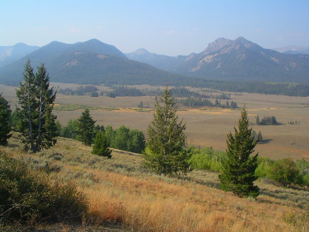 One thing that hasn't changed, you'll be happy to hear, is the view of the headwaters of the Salmon River, north of Ketchum and just over the Galena Summit. It looks just how you described when you wrote this obituary for a friend, decades ago:
Best of all he loved the fall
The leaves yellow on the cottonwoods
Leaves floating on the trout streams
And above the hills
The high blue windless sky
Now he will be part of them forever
9.20.2006
Atomic City
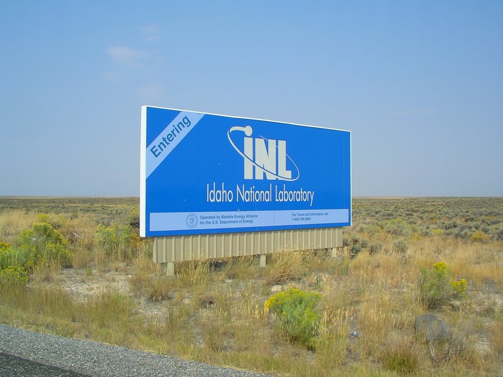 In the middle of a vast sagebrush sea, where lava beds the color of black charcoal rise like giant ocean waves and ancient streams run underground into the Snake River, sits the Idaho National Laboratory. Or so that's what the place is called today. Operated by the U.S. Department of Energy, there have been multiple names changes over the years. It started as the National Reactor Testing Station in 1949, became the Idaho National Engineering Laboratory in 1970, then the Idaho National Engineering and Environmental Laboratory in 1997, and since 2005, the Idaho National Laboratory (or even more simply, the letters "INL"). Regardless of the name, the purpose of the site has always been the same: to research peaceful atomic energy production.
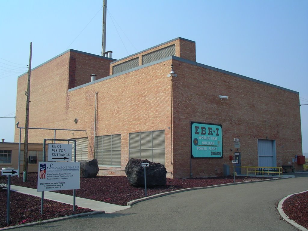 The facility (which employs some 3,300 people in a massive complex of buildings and structures closed to the public known as "Atomic City"), was created after the end of WWII, when government scientists began to focus on civilian applications of atomic fission. In order to do the research, the eggheads wanted a site with: 1. lots of room (like a million acres), 2. not many people around (in case the shit goes half-life) and, 3. stable geology (earthquakes would be a problem). The Idaho desert plain met all three pre-requisites, and over the course of the last fifty years, fifty nuclear reactors have been in operation at one time or another. The most famous being EBR-1, as seen here. On August 21, 1951, the reactor went critical for the first time. On December 20, 1951, the reactor created enough power to light up four 200 watt bulbs. Four years later, on July 17, 1955, "Expirimental Breeder Reactor-1" made history when the streetlights in the nearby desert enclave of Arco became the first in the world to be powered by atomic energy.
Any jubilation was short-lived however, as five months later, EBR-1 suffered an operator-caused partial meltdown. Things got even worse in 1961, when an expirimental reactor named SL-1 had a complete meltdown and killed three workers, the first peace-time atomic fatalities in the United States. Due to exceptional levels of isotope contamination at the accident scene, lead coffins had to be used for the burials. Rusting in the desert sun next to the EBR-1 building are two prototype propulsion reactors for nuclear bombers (later made obsolete by ICBM's), providing a glimpse into how fine the line is between civilian-use energy research and weapon making. It reminded us of Iran, and the high-stakes chess game being played right now (private message to our loyal readership in Tehran: If y'all are just powering up your homes and schools and factories like you say you are, then stop all the foolishness and let international inspectors take a look. This situation has real potential to spiral out of control. Like start WWIII).
 Five decades after the INL harnessed the power of the atom and lit up a desolate corner of Idaho, 104 commercial nuclear powerplants now produce 20% of our nation's electricity. No acid rain is produced and no rivers are dammed in the process. Today, the INL is researching new atomic applications, such as long-life plutonium technology (called radioisotope thermoelectric generators by lab nerds, they are essentially super batteries used in space probes and artificial hearts). If we could find a safe way to deal with the waste, if we could stop rogue countries from converting peaceful energy production into atomic bombs, then we'd party like it was July 17, 1955 again.
9.18.2006
The Twin Falls Plunge
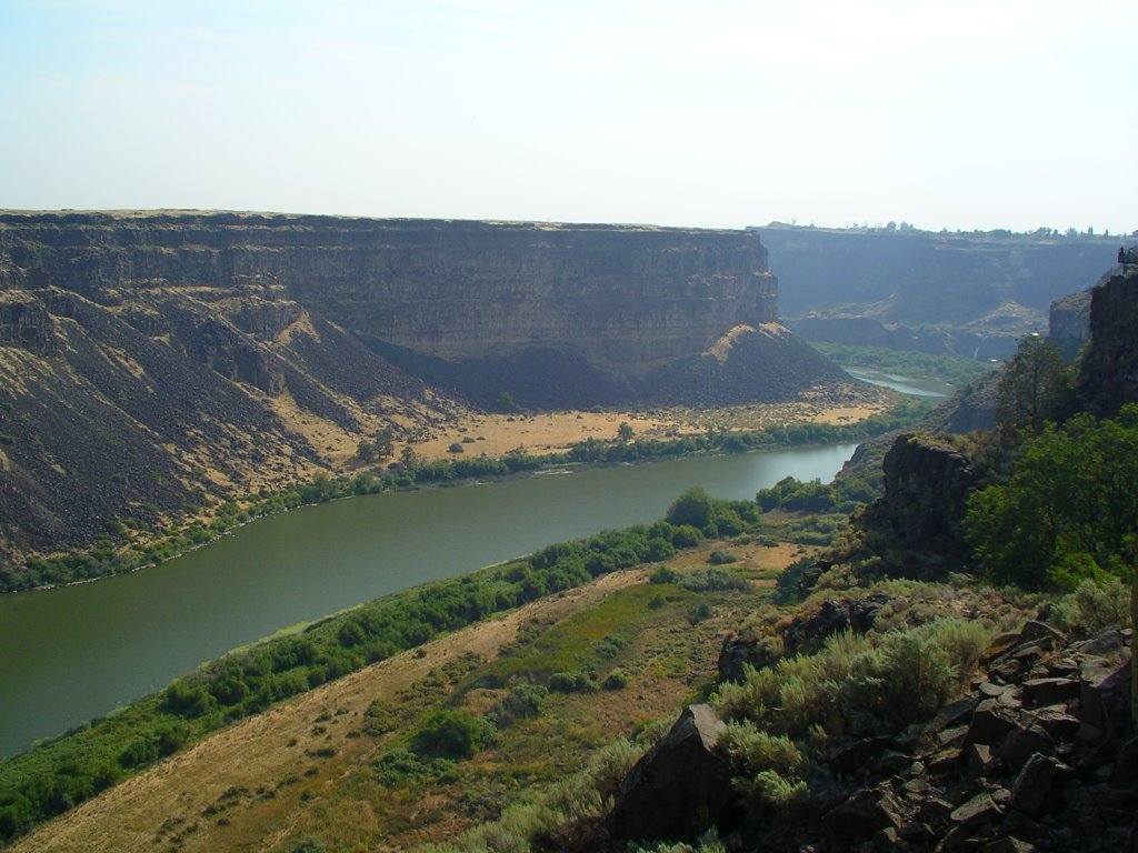 Twin Falls (pop. 35,000) is located in south-central Idaho, where the Snake River cuts wide and deep through the high desert plateau. Three waterfalls sit upriver of Twin Falls, the highest being Shoshone Falls. With a vertical drop of 212 feet, Shoshone Falls is the end of the line for the few remaining native salmon that make it past the downstream hydroelectric dams. Additional tidbits of local trivia include Nikki Sixx of Motley Crue grew up here, and in 1974, Evel Knievel attempted to jump the chasm in his X-2 Skycycle rocket. Thousands of people watched Knievel shoot into the sky and drift unceremonously into the cliffside, thanks to the accidental deployment of his parachute as the rocket left the launch ramp. The remains of the ramp are still visible on the south rim of the canyon, a permanent monument to the unintended failure of an unbridled ego.
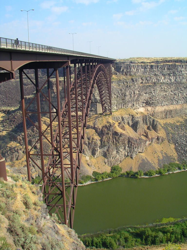 Today, Twin Falls is best known as the only place in the United States where you can BASE jump ("buildings, antennae, spans, and earth") without restriction. While we stood atop the canyon rim, several jumpers (some with British or perhaps Australian accents) watched as friends leaped into the 486 foot gap between Perrine Bridge and earth. One of them talked about the growing number of serious BASE jumping adherents who move to Twin Falls and get low-paying schlep jobs so they can jump every day. In Twin Falls, researchers who study abnormal brain function would find an ample supply of human specimens who jump off bridges in order to feel, well, normal.
As you might expect, the hobby of jumping from bridges and such has not been void of tragedy. One hundred people have died while BASE jumping over the years (click here), and since 2002, three people have died jumping off the Perrine Bridge. The most recent fatality was in May, when a California woman slammed into the Snake River with the velocity of a cruise missile after her chute failed to open. It must be a most unsettling way to die: you realize every nano-second that passes after you willingly jumped from a rapidly-shrinking bridge means you're another nano-second closer to death.
We witnessed a jump where everything went as intended, which was a very good thing.
9.17.2006
Westward Ho
 Overheard at the Boise Airport Avis car rental counter:
RR: Hi, we have a rental car reservation.
Dippy girl behind counter: Ok, you can have either a Saturn Ion or a mini-van.
RR: Uh, no. We pre-paid for a full-size car through Priceline. Here's the receipt.
Dippy girl behind counter (while fumbling through various keys in the drawer): Um, OK. How about a Chrysler Sebring convertible?
RR: Sweet. We'll take it. Bah bye. And so began our return to the Pacific Northwest, a place we lived for several years back in the day and a place we've since returned to often for rafting trips, hunting trips, and just disappear trips. For the next several postings, you'll ride shotgun in the RR convertible and visit places known, places unknown, and places long forgotten. We'll cross over the alpine headwaters of major rivers and pass through dusty desolate desert outposts onward to salty ocean fishing villages. We'll visit sun-kissed ski towns for the rich and beautiful, old gold mines far off the map where the only inhabitants are dead miners with fading wooden grave markers, and secret places known only to locals with well-worn leather boots.
 Little will slow us down. The only road hazard will be the many lightning-strike fires which have burned hundreds of thousands of forest acres this summer, and will likely keep burning until the snow begins to fall in a month or two. The mountain skyline was often obscured from all directions by an omnipresent smoky haze, further excerbated by a low system from Canada which allowed nightly inversions to perpetuate the condition day after day.
 These fires kept us from getting into a couple of remote backwoods locations, but made for interesting sunsets, to say the least. As seen here at dusk in Stanley, Idaho (population 170), one of our favorite mountain towns in the region, where thankfully the Black Butte Porter tap at the Mountain View Lodge continued to pour despite the ever-present threat of fire.
As we headed south over Galena Summit (elevation 8,701 feet), en route to Sun Valley, the smoke began to wane and the sky returned to a familiar Idaho cobalt blue. Here's how the drive looked with the top down, as we descended through lodgepole pine forest at Mach III speed. Buckle up.
Subscribe to:
Posts (Atom)

