 Please accept our most sincere apologies from all of us at Riverrant. Our mission statement proclaims this blog will center on rivers and all things collateral, but instead we've been warbling on about toothaches and politics. We hope you aren't too disappointed with the digressions.
But hopefully this posting will bring us back to our raison d'etre, although summer is rapidly disappearing and it may be months before another river expedition is chronicled. Once a year, there has to be a serious river trip. We're not talking two inner tubes and a cooler. It must involve cooking over open firex, big oar rafts, and pooping in a bucket. Other basic requirements include it's somewhere out west or in Canada and lasts (at least) a week.
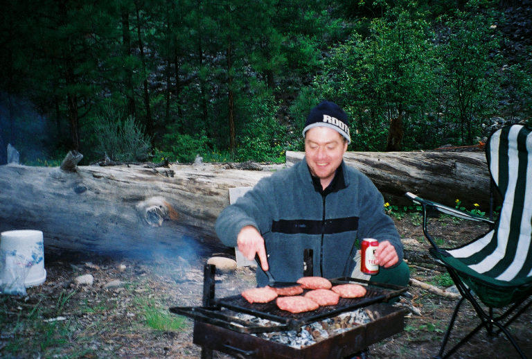 Even when the weather is bad, even when you get covered in poison ivy, even when the toilet paper gets wet on the first day, these trips rule. They are the perfect mix of high adventure, incredible scenery, interesting geology, friendship, beer, and killer meals. As long as I am ambulatory, I'll be running these rivers.
So the big trip of 2005 was the Middle Fork of the Salmon River in central Idaho. The Owyhee, the Main Fork of the Salmon, the John Day, the Petawawa, and the Snake are among the other favorites, but this year we ran one of the most spectacular, most revered, and most challenging long runs in North America.
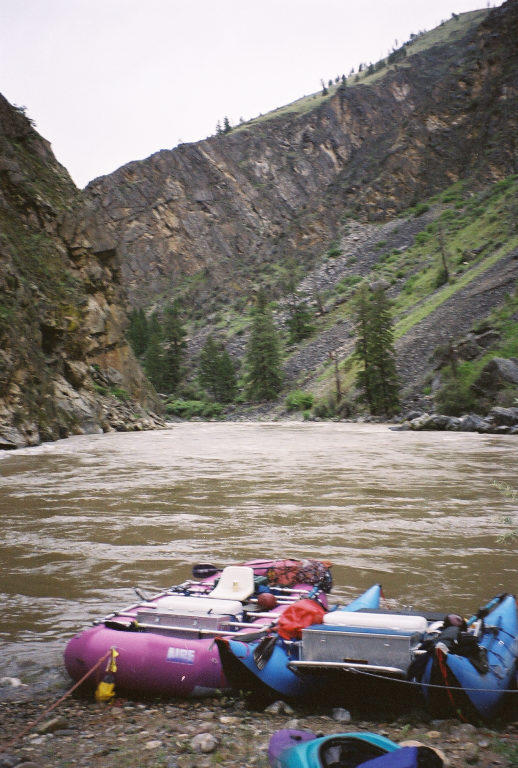
Originating from the high peaks of the Sawtooth Mountains, the Middle Fork of the Salmon River flows some 100 miles before joining the Main Fork. After the launch at Boundary Creek, no roads access until the take-out. The river bisects the two million acre Frank Church Wilderness of No Return, the largest roadless area in the lower 48. Bald eagles soar high over batholith-era granite cliffs. Shoshone Indian petroglyphs and their traditional summer campsites dot the river corridor. Hot springs bubble up from pre-historic volcanic vents. Over 100 rapids provide ample challenge for journeyman boaters. Other than a handful of old mining cabins or century-old hard scrabble ranches, there is minimal sign of modern man. The journey to the launch had signs of bad luck, which is never a good thing. First of all, my bags were lost by Northwest Airlines (but do show up the next day). Then, on the drive up from Boise, we pass a serious motorcycle accident on a tight mountain curve. Two Harleys, riding parallel, bumped into each other, sending one rider into the rock wall and the other into the guardrail. Idaho State Troopers hover over crumpled bikes and blood stains on the asphalt. Leather jackets and cracked helmets lie in the road. I'm not a strong believer in bad karma, but witnessing a gruesome scene does create reason for pause.
Then, when we pulled into Stanley, Idaho, we met a group of rafters who launched at Marsh Creek, a small tributary used when the access road to Boundary Creek is snowed in. Their gear was strewn across the motel parking lot. Their story was most unfortunate: Marsh Creek showed no love. Rafts broached on logs and punctured. People were injured and gear and group dynamics deteriorated into a classic "Lord of the Flies" battle of personalities. Ironically, their bad luck is to our advantage: they paid to have a snowcat plow the way into Boundary Creek so they could be extracated. Which allowed us to be the first party of the year to launch from the traditional Middle Fork starting point. With flows at 3.5 feet (moderately high) on the staff gage, we launched. I had my old 11' foot Achilles tub boat (a dinosaur from a bygone era that pre-dates modern day self-bailers and catarafts) that I bought ten years ago from an outfitter in Bend, Oregon who was getting rid of his old boats. As I stood there looking at the fast churning water, I knew things were going to get interesting. This river is no place for dumbshits using out-dated and undersized gear.
The stretch to Scout Camp was technical, but lines were easy to find. My small boat handled the maneuvers around Velvet Falls and through Powerhouse Rapids quite well. Then it began to rain. And the rain brought down the remaining snow melt from the high peaks,
We hunkered down for a day, waiting for better weather. The river rose to 6.5 feet on the gage, which may mean nothing to you, but at this level the U.S. Forest Service and many commercial outfitters suspend their operations as this traditional pool and drop river becomes one continous Class IV torrent of water.
A large pillow wave at Pistol Creek rapid tossed me from the boat and I flushed into a large hole. Not my first swim ever, but with water temps in the thirties, my chest tightened as my heart pumped blood to my extremities. I recovered quickly, albeit chilled and with renewed respect for the situation I'm in.
Water levels continued to peak and the heavy run-off from side canyons added muddy water and tree trunks. Eddies disappeared and huge wave trains led from one rapid into the next. Amazingly, I completed another sixty miles without incident, sneaking around big rapids and avoiding bellowing holes. Until Weber Rapids.
I hit a massive diagonal wave and flipped like a western omelet. The bow of my raft lurched into the air and landed on top of me. Dark icy water enveloped me as I spun and tumbled through violent hydrolics. I was trapped under my raft for a brief moment that seemed like eternity before I managed to push away and re-surface. The river propelled me and my over-turned raft downstream several hundred yards before another raft collected us in an eddy.
The long cold swim left my muscles fatigued and my mind fogged. Back at the helm of my raft, I could feel the power ebbing from my oar strokes. Within minutes, I hit a huge wave train below Ship Island Camp and flipped again. I swam to the shore, and watched helplessly as the rafts and kayaks in my group got swept downstream in the fast current. One of the rafts found an eddy 200 yards downstream, and Tony yelled at me to jump in and swim towards them. I jumped, only to get spun backwards into an upstream eddy and face-plant into the backside of a boulder. A gnarly circulating whirpool pressed me hard against the rock as water flowed over my head. I thought to myself, "This is how you drown." My lizard brain kicked in and I somehow I push off and swam to shore. A moment of pause occurs to process the magnitude of the situation.
I forced myself to run and jump from a small cliff ledge into the main flow of the current- not an easy step after just breaking free from a partially submerged rockpin. I swam hard towards the raft and yelled for a rescue rope. Tony and Big Jim tossed it and pulled me in. Whew. I'm safe, but cold. Real cold. We mase it another couple of miles to Cradle Creek camp to where my boat and gear are recovered. A very hospitable and generous party we launched with had warm tea and beef stroganoff on the stove. Angels sent by the Big Rafter in the sky! My clothes got stripped off and I slowly began to warm in front of the fire, fully aware my next trip could have been down the River Hades.
 On the last day, the skies broke indigo blue and we came out one big happy party. My boat was deflated and packed up for the last ten miles- better not push my luck. The little Achilles made it ninety miles on a swollen mountain river during high flow. That's worth celebrating with a Deschutes Porter. It was a great trip. Good company, spectacular scenery, great hot springs, and more adventure than I could ask for. All limbs intact and no gear lost. But next time, I'll be in a 14' self-bailing Maravia.
Mike, Tony, Jim, Emily, Iayana, Cat, Rick, and the two doctors: Thanks for a great trip and saving my bacon. SYOTR.
Editors note: in the years since this trip, both Tony and Rick have passed away. After decades of boating, this was their last trip.

